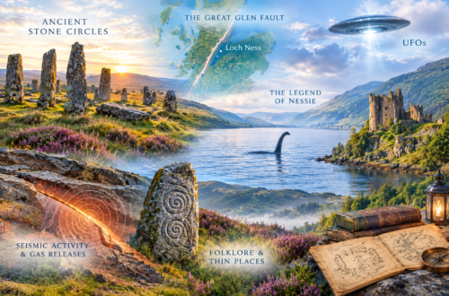
I’m now conviced more than ever a prolonged trip to the rugged beauty of the Highlands of Scotland is in order! The stunning landscapes, glorious wilderness and cultural landmarks to explore!
It seems there are many different definitions to the areas that encompass the Highlands, depending on who you ask, or what website you visit.
For my purposes, since I love the medieval period, I’m limiting my research of the ancient recumbent and related stone circles stones within the HISTORIC HIGHLANDS.
Historic Highlands
- The Highland Line region — from the Firth of Clyde near Helensburgh northeast through the Loch Lomond/Stirling area, Perthshire, Angus and the Mearns toward the Moray Firth. The territory north and west of this general transition forms the broad geographic Highlands.
- Argyll — including Kintyre, Lorn, Cowal and Knapdale; the historic Gaelic heartland associated with Dál Riata.
- The Western Isles and Hebrides — Lewis, Harris, Uist, Skye, Mull, Islay, Jura and the other Hebridean islands associated with the Gaelic/Highland world and later the Lords of the Isles.
- Lochaber, Morvern, Moidart, Knoydart and Kintail — the western seaboard.
- Badenoch and Strathspey — the central Highland glens.
- Atholl, Breadalbane and Rannoch — the southern/central Highland areas of Perthshire.
- Ross and Cromarty — including Easter Ross and Wester Ross.
- Sutherland and Caithness — the far north, with the important qualification that Caithness had substantially stronger Norse influence and was culturally distinctive.
- Moray, Nairn and the Great Glen — including Inverness and the Great Glen corridor.
ARGYLL & THE ISLES
Kilmartin Glen. Kilmartin Glen contains one of Scotland’s richest prehistoric landscapes, with more than 350 ancient monuments within six miles of Kilmartin village. Notable sites include the Temple Wood stone circles, dating to about 3000 BC. The southern circle retains 13 standing stones from an original ring of about 20, while the northern circle is smaller. Nearby, the Nether Largie standing stones rise as high as 2.8 metres and are aligned northeast to southwest. The Ballymeanoch monument features a striking avenue of standing stones, including one that exceeds 4 metres in height.
Ballochroy, Kintyre. Ballochroy on the west coast of Kintyre features a remarkable prehistoric alignment of three standing stones overlooking views of Islay and Jura. The stones appear intentionally aligned with prominent landscape features, including Cora Bheinn on Jura, about 19 miles away, and Beinn a’ Chaolais, the southernmost of the Paps of Jura, suggesting a deliberate connection between the monument and the surrounding landscape.
Isle of Mull. Lochbuie Stone Circle on the Isle of Mull occupies a dramatic setting beneath Ben Buie near the island’s southern coast. The circle originally consisted of nine granite stones arranged in a ring about 12 metres in diameter, with the tallest stone reaching approximately 2 metres in height. The stones were placed with their flatter faces oriented toward the center of the circle. Three additional standing stones lie nearby, including a prominent 3-metre-high monolith.
Isle of Coll. The remote Hebridean island of Coll contains numerous prehistoric sites, including cairns, Iron Age forts, and crannogs. Among the most notable are the two Na Sgeulachan (“Teller of Tales”) standing stones at Totronald on the island’s western side. Their original purpose remains uncertain, though they may have served an astronomical function or formed part of a ritual temple or ceremonial site.
Islay & Jura. Islay and Jura contain several notable standing stones. On Jura, the tallest standing stone is Camus-an-Staca near Ardfin, while another notable stone stands at Tarbert near the old cemetery. On Islay, Carragh Bhan Standing Stone overlooks the Paps of Jura and is linked by local legend to the grave of the Norse-Gael ruler Godred Crovan. The island also features the striking Lagavulin Stone Row, where one stone stands about 11 feet high and a second fallen stone measures approximately 12 feet in length.
Bute. Bute has several prehistoric stone sites, including Ettrick Bay Stone Circle, with eight stones forming a 13-metre circle, and Kingarth Stone Circle, where three stones remain standing. Additional standing stones are located near Largizean Farm.
There are 61 castles, only some of which are accessible to the public:
- Dunstaffnage Castle and Chapel – MacDougalls Stronghold [1240]
- Iona Abbey – one of Scotland’s most sacred sites. [1200s]🛥
- Castle Stalker – privately owned, limited tours available. [1320] 🛥
- Rothesay Castle
- Strontoiller
- Cultoon
- Beinn an Tuirc
- Scalasaig South
- Tenga — possible stone circle
—————-
Core historic Highland areas
- Sutherland
- Caithness
- Ross-shire
- Cromartyshire
- Inverness-shire
- Nairnshire
- Argyllshire
- Bute
- Lochaber
- Badenoch
- Strathspey
- Skye
- Inner Hebrides
- Outer Hebrides
- Highland portions of the transitional counties
- Perthshire
- Aberdeenshire
- Moray
- Banffshire
- Angus/Forfarshire
- Stirlingshire
- Dunbartonshire
Core Historic Highlands
- Argyllshire
- Bute
- Caithness
- Inverness-shire
- Nairnshire
- Ross-shire
- Cromartyshire
- Sutherland
- Dunbartonshire
- Skye
- Inner Hebrides
- Outer Hebrides
- Historically Highland/Gaelic portions of
- Perthshire
- Aberdeenshire
- Moray/Elginshire
- Banffshire
- Angus/Forfarshire
- Stirlingshire
Northeast Scotland
Ancient recumbent and related stone circles, in various conditions, are still in existence:
- Aikey Brae, Old Deer
- Aquhorthies, Banchory-Devenick
- Ardlair, Kennethmont
- Auchlee, Banchory-Devenick
- Balquhain, Chapel of Garioch
- Berrybrae, Lonmay
- Blue Cairn of Ladieswell, Logie Coldstone
- Candle Hill, Insch
- Castle Fraser, Cluny
- The Cloch, Benholm
- Clune Wood, Durris
- Corrie Cairn, Tullynessle and Forbes
- Corrydown, Auchterless
- Cothiemuir Wood, Keig
- Druidstone, Premnay
- Easter Aquhorthies, Inverurie
- Eslie the Greater, Banchory-Ternan
- Hatton of Ardoyne, Oyne
- Kirkton of Bourtie, Bourtie
- Loanhead of Daviot, Daviot
- Loudon Wood, Old Deer
- Mains of Hatton, Auchterless
- Midmar Kirk, Midmar
- Netherton of Logie, Crimond
- The Nine Stanes (Garrol Wood), Banchory-Ternan
- North Strone, Alford
- Old Keig, Keig
- Old Kirk of Tough, Cluny
- Old Rayne, Rayne
- Pitglassie, Auchterless
- Rothiemay, Moray
- South Fornet, Skene
- Stonehead, Insch
- Strichen House, Strichen
- Sunhoney, Midmar
- Tillyfourie, Monymusk
- Tomnagorn, Midmar
- Tomnaverie, Coull
- Tyrebagger, Dyce
- Wester Echt, Echt
- Yonder Bognie, Forgue
- Hillhead, Tarland
- Nether Coullie, Monymusk
- Cullerlie, Echt (a kerbed circle, not recumbent)
Day Trip 1: Inverurie / Garioch / Insch Cluster
- Balquhain, Chapel of Garioch (ruins)
- Easter Aquhorthies, Inverurie (good)
- Hatton of Ardoyne, Oyne (good)
- Kirkton of Bourtie, Bourtie (ruin)
- Loanhead of Daviot, Daviot (good)
- Old Rayne, Rayne (ruin)
- Druidstone, Premnay (ruin)
- Candle Hill, Insch (ruin)
- Stonehead, Insch (ruin)
- Ardlair, Kennethmont (ruin)
- Tillyfourie (Whitehill), Monymusk (ruin)
- Nether Coullie, Monymusk (ruin)
- Tyrebagger, Dyce (good)
Base: Inverurie
Driving: Most sites within 30–40 minutes of each other.
- Aikey Brae, Old Deer — ruin – recumbent stone circle in abershire.
- Aquhorthies, Banchory-Devenick — good
- Ardlair, Kennethmont — ruin
- Auchlee, Banchory-Devenick — ruin
- Balquhain, Chapel of Garioch — ruin
- Berrybrae, Lonmay — ruin
- Blue Cairn of Ladieswell, Logie Coldstone — ruin
- Candle Hill, Insch — ruin
- Castle Fraser, Cluny — good
- The Cloch, Benholm — uncertain
- Clune Wood, Durris — ruin
- Corrie Cairn, Tullynessle and Forbes — uncertain
- Corrydown, Auchterless — ruin
- Cothiemuir Wood, Keig — ruin
- Druidstone, Premnay — ruin
- Easter Aquhorthies, Inverurie — good
- Eslie the Greater, Banchory-Ternan — ruin
- Hatton of Ardoyne, Oyne — good
- Kirkton of Bourtie, Bourtie — ruin
- Loanhead of Daviot, Daviot — good
- Loudon Wood, Old Deer — ruin
- Mains of Hatton, Auchterless — ruin
- Midmar Kirk, Midmar — OK (restored)
- Netherton of Logie, Crimond — ruin
- The Nine Stanes (Garrol Wood), Banchory-Ternan — ruin
- North Strone, Alford — good
- Old Keig, Keig — ruin
- Old Kirk of Tough, Cluny — ruin
- Old Rayne, Rayne — ruin
- Pitglassie, Auchterless — ruin
- Rothiemay, Rothiemay (Moray council area) — ruin
- South Fornet, Skene — ruin
- Stonehead, Insch — ruin
- Strichen House, Strichen — OK (fully reconstructed)
- Sunhoney, Midmar — good
- Tillyfourie (Whitehill), Monymusk — ruin
- Tomnagorn, Midmar — ruin
- Tomnaverie, Coull — OK (restored)
- Tyrebagger, Dyce — good
- Wester Echt, Echt — ruin
- Yonder Bognie, Forgue — ruin
- Hillhead, Tarland — one stone survives (later addition)
- Nether Coullie, Monymusk — one stone survives (later addition, reclassified 2015)